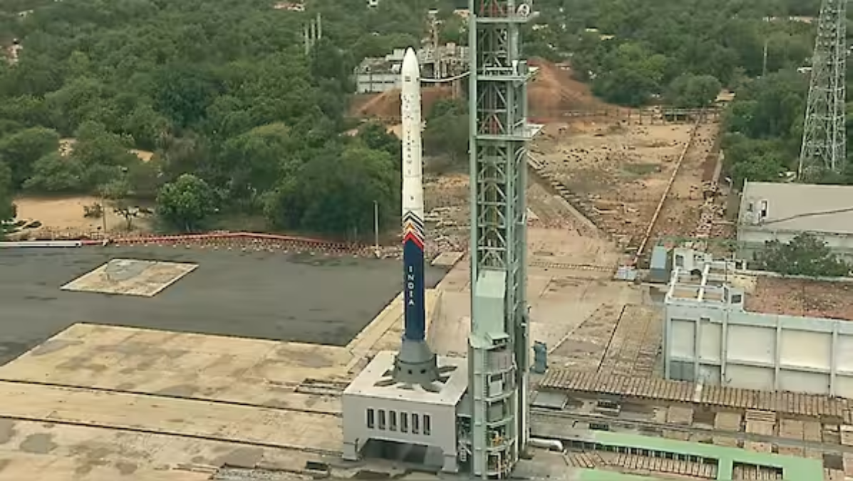
In a historic breakthrough in Indo-US space cooperation, the India-US jointly developed NASA-ISRO Synthetic Aperture Radar (NISAR) satellite was launched successfully in the evening on Thursday.
The mission blasted off on the Indian Space Research Organisation's (ISRO) GSLV-F16 rocket from the Satish Dhawan Space Centre in Sriharikota in Andhra Pradesh at 5:40 pm.
Confirming the successful launch, ISRO posted on social media site X: "We have liftoff! GSLV-F16 has successfully launched with NISAR onboard."
Union Minister of State for Science and Technology, Dr. Jitendra Singh, also tweeted the success, "writing on X, "#GSLV-F16 lifts off with the NASA–#ISRO NISAR Earth Observation Satellite."
Around 19 minutes after launch, the satellite will be inserted into a 743-km sun-synchronous orbit — the first time ISRO's GSLV has launched a satellite into this kind of orbit.".
NISAR is the first joint Earth-observing mission between NASA and ISRO, uniting technical expertise on both sides.
"Go NISAR! The NASA-India satellite flying on @ISRO's Geosynchronous Launch Vehicle departed the southeast coast of India at 8:10am ET (1210 UTC) on its way to map Earth's evolving land and ice surfaces," NASA tweeted on X.
The $1.5 billion initiative is poised to transform the monitoring of environmental shifts and natural disasters, offering constant, all-weather, day-and-night imagery of Earth’s surface.
“It can take pictures of the Earth 24 hours a day in all weather conditions and the satellite can detect landslides, aid in disaster management, and monitor climate change,” said ISRO Chairman Dr. V Narayanan.
This mission highlights the increasing cooperation between the United States and India in space exploration. It comes after the summit of the leaders in Washington, D.C., where Prime Minister Narendra Modi and President Donald Trump indicated 2025 as an important year for developing civil space collaboration between the two countries.
Weighing 2,392 kilograms, the satellite will be orbiting at 740 km altitude and image Earth's land and ice surfaces every 12 days, taking high-resolution images over a 242-kilometre swath using sophisticated SweepSAR technology.
NISAR is a world-first — using dual-frequency Synthetic Aperture Radar (SAR) involving both L-band and S-band radars.
NASA added the L-Band SAR, a high-rate telecommunication system, GPS receiver, and a 12-meter deployable mesh antenna. ISRO added the S-Band SAR, the spacecraft bus to accommodate the payloads, the GSLV-F16 launch vehicle, and associated launch operations.
The twin radar system of the satellite is installed on an ISRO-built custom I-3K satellite bus and will leverage NASA's 12-meter antenna for data gathering.
When it becomes operational, NISAR will track seismic activity, volcanic eruptions, landslides, and tsunamis, as well as chart slow surface movements in Earth's crust. Its information will also be crucial for mapping agricultural regions, monitoring crop health, noting shoreline changes, identifying ships, classifying sea ice, and observing soil moisture variability.
The pathfinder mission will reportedly give a major fillip to global coverage in environmental monitoring and disaster readiness.
Read also| Daya Nayak Promoted to ACP Just Two Days Before Retirement
Read also| Army Foils Infiltration Attempt on LoC in Poonch, Two Terrorists Eliminated